The tall limestone cliffs and turquoise water of the Bruce Peninsula provide a variety of recreational opportunities for residents and visitors alike. Credit: Scott Parker
Sharing information on Best Management Practices is an important part of collaboration between the individuals, communities, watershed groups and governmental agencies at work for Lake Huron. Credit: BPBA
Exposed limestone bluffs at Cave Point, Bruce Peninsula.
Rocky islands of eastern Georgian Bay. Photo credit: Ellen Perschbacher
Southern Ontario agriculture along Lake Huron’s southeast shore. Credit: Daniel Holm Photography
Sand beach and dune complexes are found along the southeastern shores, such as those pictured here near Pinery Provincial Park. Credit: Daniel Holm Photography
Lake Huron waters support a thriving agricultural sector, particularly in the southeastern portion of the watershed. Credit: Daniel Holm Photography
Volunteers engaged in stream restoration efforts in a Lake Huron tributary. Photo credit: MSIA
Rocky islands of eastern Georgian Bay. Photo credit: Ellen Perschbacher
The St. Marys River flows from Lake Superior to Lake Huron, contributing 8 billion liters/hour to the receiving basin in Lake Huron. Photo credit: Mark Chambers

Cover Crop Boost Program and 60-inch Row Corn Demonstration

<< Back to project list

Through the support of several partners, Ausable Bayfield Conservation has been able to offer farmers in the Main Bayfield watershed an enhanced cover crop funding program. With this boost in funding, the goal is to not only have more acres covered throughout the winter and spring, but also to provide more opportunity for farmers to try cover crops in their rotation.

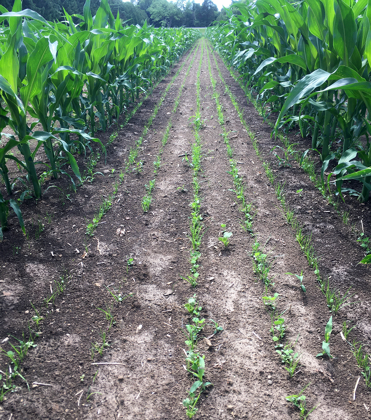
In addition, a demonstration project just outside of Clinton, Ontario, is looking at cover crops and whether 60-inch corn rows can help establish a cover crop better than 30-inch rows. Wider corn rows can increase light penetration to the ground to improve cover crop establishment, but the impact on corn yield or the following bean yield is not known. Twin rows of 60-inch corn were planted in early May, and the cover crop mix was drilled in at the V4 stage in early June. Corn yield, cover crop biomass production and soil health indicators will be monitored this fall, with monitoring continuing into 2021.

Nearest city or town: Clinton, Ontario
Project start date: May 1, 2020

Project focus: Combination of Education, Restoration, and Monitoring
Project contact: Hope Brock

Visit Project Website

Back to the Project List Share Your Project