The tall limestone cliffs and turquoise water of the Bruce Peninsula provide a variety of recreational opportunities for residents and visitors alike. Credit: Scott Parker
Sharing information on Best Management Practices is an important part of collaboration between the individuals, communities, watershed groups and governmental agencies at work for Lake Huron. Credit: BPBA
Exposed limestone bluffs at Cave Point, Bruce Peninsula.
Rocky islands of eastern Georgian Bay. Photo credit: Ellen Perschbacher
Southern Ontario agriculture along Lake Huron’s southeast shore. Credit: Daniel Holm Photography
Sand beach and dune complexes are found along the southeastern shores, such as those pictured here near Pinery Provincial Park. Credit: Daniel Holm Photography
Lake Huron waters support a thriving agricultural sector, particularly in the southeastern portion of the watershed. Credit: Daniel Holm Photography
Volunteers engaged in stream restoration efforts in a Lake Huron tributary. Photo credit: MSIA
Rocky islands of eastern Georgian Bay. Photo credit: Ellen Perschbacher
The St. Marys River flows from Lake Superior to Lake Huron, contributing 8 billion liters/hour to the receiving basin in Lake Huron. Photo credit: Mark Chambers

In Praise of Biodiversity: Birds, Bears, and Blandings

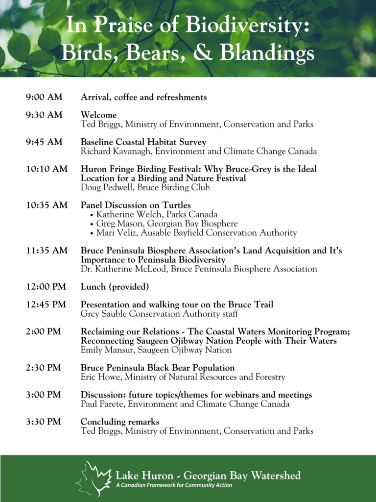
We are continuing to come together to see how communities around Lake Huron and Georgian Bay are working to help monitor and protect their local ecosystem with the next topic being ‘In Praise of Biodiversity: Birds, Bears, and Blandings”.

We are planning an in-person meeting in Owen Sound at the Grey-Sauble Conservation Authority office on May 16, from 9:00 to 3:30pm. At this meeting we will be hearing from community groups and agencies about turtles, birds, and mammals as well as ongoing efforts on the enhancement of coastal habitat. We also look forward to hearing from you!

Space for this meeting is limited to 50 participants so if you are interested in attending the meeting, please register at the link below. 

Register HERE