The tall limestone cliffs and turquoise water of the Bruce Peninsula provide a variety of recreational opportunities for residents and visitors alike. Credit: Scott Parker
Sharing information on Best Management Practices is an important part of collaboration between the individuals, communities, watershed groups and governmental agencies at work for Lake Huron. Credit: BPBA
Exposed limestone bluffs at Cave Point, Bruce Peninsula.
Rocky islands of eastern Georgian Bay. Photo credit: Ellen Perschbacher
Southern Ontario agriculture along Lake Huron’s southeast shore. Credit: Daniel Holm Photography
Sand beach and dune complexes are found along the southeastern shores, such as those pictured here near Pinery Provincial Park. Credit: Daniel Holm Photography
Lake Huron waters support a thriving agricultural sector, particularly in the southeastern portion of the watershed. Credit: Daniel Holm Photography
Volunteers engaged in stream restoration efforts in a Lake Huron tributary. Photo credit: MSIA
Rocky islands of eastern Georgian Bay. Photo credit: Ellen Perschbacher
The St. Marys River flows from Lake Superior to Lake Huron, contributing 8 billion liters/hour to the receiving basin in Lake Huron. Photo credit: Mark Chambers

Manitoulin Island Traditional Knowledge/Watershed Management Project

<< Back to project list

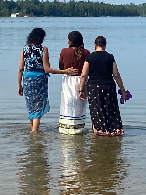
Our Waterkeeper position created water awareness to empower indigenous women and girls as existing and future leaders of water protection/restoration by strengthening their relationship as Waterkeepers.
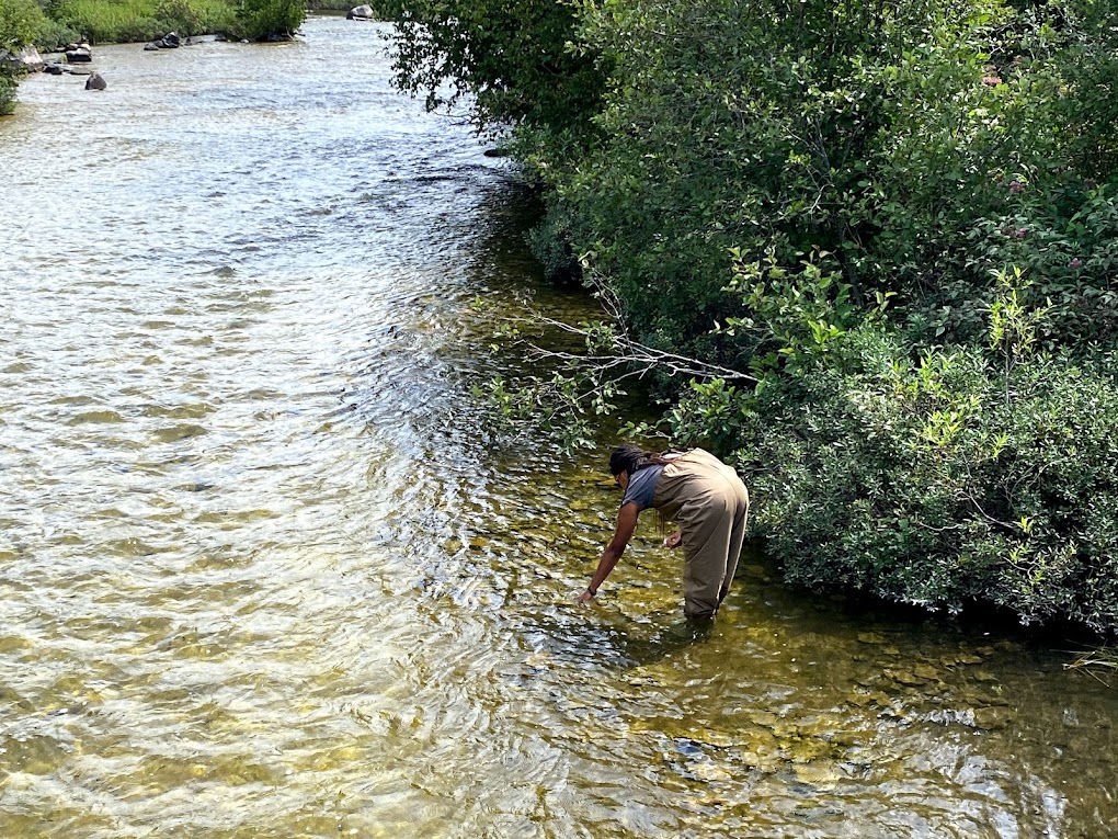
• Collection and analysis of 45 water samples from 14 Manitoulin Island stream watersheds
• Control and maintenance of phragmites at 45 sites
• 28 bags of garbage removed from 5 communities
• Knowledge Transfer Interview with Traditional Waterkeeper Carroll Kitchikake: www.youtube.com/watch?v=MhkXrCVw8yE&t=8s
• Traditional Ceremonial Water Walk with public involvement
• Certification Invertebrate CABIN & OBBN protocols
• Social media/ water educational awareness
• Stream restoration completed along Smith Bay Creek (63m shoreline, 160m2 in-stream)
• www.manitoulin.com/manitoulin-streams-waterwalker-holds-inaugural-wa
lk-in-little-current/
• www.fcc-fac.ca/en/about-fcc/media-centre/customer-stories/manitoulin
-brewing-indigenous-heritage.html

Nearest city or town: Wikwemikong, ON
Project start date: July 5, 2021
End date: October 31, 2021

Project focus: Combination of Education, Restoration, and Monitoring
Project contact: Seija Deschenes

Visit Project Website

Back to the Project List Share Your Project