The tall limestone cliffs and turquoise water of the Bruce Peninsula provide a variety of recreational opportunities for residents and visitors alike. Credit: Scott Parker
Sharing information on Best Management Practices is an important part of collaboration between the individuals, communities, watershed groups and governmental agencies at work for Lake Huron. Credit: BPBA
Exposed limestone bluffs at Cave Point, Bruce Peninsula.
Rocky islands of eastern Georgian Bay. Photo credit: Ellen Perschbacher
Southern Ontario agriculture along Lake Huron’s southeast shore. Credit: Daniel Holm Photography
Sand beach and dune complexes are found along the southeastern shores, such as those pictured here near Pinery Provincial Park. Credit: Daniel Holm Photography
Lake Huron waters support a thriving agricultural sector, particularly in the southeastern portion of the watershed. Credit: Daniel Holm Photography
Volunteers engaged in stream restoration efforts in a Lake Huron tributary. Photo credit: MSIA
Rocky islands of eastern Georgian Bay. Photo credit: Ellen Perschbacher
The St. Marys River flows from Lake Superior to Lake Huron, contributing 8 billion liters/hour to the receiving basin in Lake Huron. Photo credit: Mark Chambers

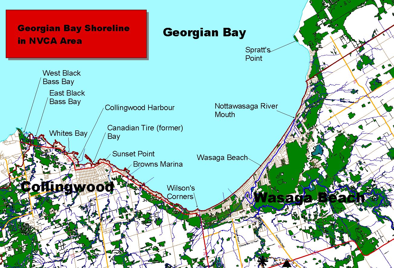
Southern Georgian Bay represents the southernmost tip of Georgian Bay as well as the gateway to the 30,000 Islands – the largest concentration of freshwater islands in the world. Wasaga Beach, a popular 14 km sandy beach, proudly flies a Blue Flag – an international ecolabel for water quality and environmental management. Outletting into Southern Georgian Bay, the Nottawasage River provides excellent fishing and spawning habitat for many species of fish, including the rare Lake Sturgeon.

Annual Reports

Nottawasaga Valley Conservation Authority

2016 Summary Report

2015 Summary Report

2014 Summary Report

2013 Summary Report

More pictures from 2013 for Nottawasaga Projects (pdf 7.92 mb)